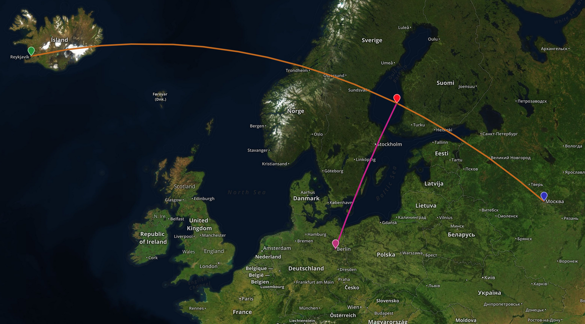
2つの緯度/経度のペアで構成される線と、ポイントの緯度/経度があります。線と地球表面上の点(地球を大球体と見なすことができる)との間の垂直距離、および最小垂直ベクトル(つまり、線上に投影された「クロスポイント」)を調べたいのですが。
私はこれにGeotools 8.0とJTSを使用しようとしています。以下は私のテストコードをキャプチャしました:
    //Coordinates in lon, lat
    Coordinate linePt1 = new Coordinate(-5.71472, 50.06639);
    Coordinate linePt2 = new Coordinate(-3.07000, 58.64389);

    //Multiply all longitudes by the cosine of latitude.
    //http://gis.stackexchange.com/a/29713/10772
    linePt1.x = linePt1.x * Math.cos(linePt1.y);
    linePt2.x = linePt2.x * Math.cos(linePt2.y);

    LineString line = createLine(new Coordinate[]{linePt1, linePt2});

    Coordinate pt1 = new Coordinate(-6, 54);
    pt1.x = pt1.x * Math.cos(pt1.y);
    Point point = createPoint(pt1.x, pt1.y);

    double distanceOp = DistanceOp.distance(line, point);
    System.out.println("Distance = " + distanceOp);

    //Find the minimum perpendicular vector using "closestPoints()"
    for (Coordinate c : DistanceOp.closestPoints(line, point)) {
        System.out.println("=== " + c);
        //verify if the point is on the line
        System.out.println(CGAlgorithms.isOnLine(c, new Coordinate[]{linePt1, linePt2}));
    }
createPoint()およびcreateLine()メソッド:
public static LineString createLine(Coordinate[] coordinates){
    GeometryFactory factory = new GeometryFactory(new PrecisionModel(
            PrecisionModel.FLOATING), WGS84_SRID);
    LineString line = (LineString) factory.createLineString(coordinates);
    return line;
}

public static Point createPoint(double longitude, double latitude) {
    if (longitude < -180 || longitude > 180) {
        throw new IllegalArgumentException(
                "Longitude should be between -180 and 180");
    }
    if (latitude < -90 || latitude > 90) {
        throw new IllegalArgumentException(
                "latitude should be between -90 and 90");
    }
    GeometryFactory factory = new GeometryFactory(new PrecisionModel(
            PrecisionModel.FLOATING), WGS84_SRID);
    Point point = (Point) factory.createPoint(new Coordinate(longitude,
            latitude));
    return point;
}
ただし、「isOnLine()」の結果はfalseを返します。何か問題があるのかと思っていました。
私の検証方法に何か問題がありますか、または実際に私が垂直距離と地球表面の「クロスポイント」を見つけるために使用した方法が正しくありませんか?
@hepiladron、ご提案ありがとうございます。PrecisionModel.FIXEDを使用して試したが、同じ結果が得られた...
—
xlogger
将来の読者のために-JTSがデカルトフレームワークを想定しており、球形ジオメトリをまったく処理しないため、これはうまくいかない可能性があります。
—
イアンTurton

PrecisionModel.FIXEDか?残りのコードについてはコメントできませんが、倍精度ではエラーが発生する可能性があります。JTS FAQのRobustness&Precisionを参照してください。